


When we decided to write about the Wonders of the World, we used the ChatGPT. In the next step, we asked Midjourney (based on prompts) to create photos of these wonders 200, 500, and 1000 years from now. We wanted to see how artificial intelligence imagines the future of these amazing natural phenomena, and what picture it gives us of the future of the World’s Wonders. The result was interesting; both reading about the wonders of the world written by ChatGPT and comparing the real photos of these places with what artificial intelligence (Midjourney) imagines of the future. Join Fly Sepehran and enjoy reading about the “Wonders of the World”.
The Stone Garden is located in the city of Sirjan in Kerman province, Iran; a completely rocky garden with various rocks and statues that create a frightening image for visitors. You can explore this handmade stone garden, discover its unique landscapes, and immerse yourself in its illusionary scenery. There are also several caves and rock shelters in this stone garden where visitors can explore.
The Stone Garden of Sirjan is one of the most popular attractions in Sirjan County. This garden was built by a local man named “Darvish Khan” in 1961. He, who had a great interest in gardening, took an unusual step in protest when he lost his lush garden due to drought. Darvish Khan started to create strange patterns by collecting stones from the nearby mountains and rivers and placing them side by side. This is how the Stone Garden of Sirjan came into existence.
Darvish Khan added tree branches and other elements to the garden to make it look more interesting. This garden quickly became popular among locals and tourists, and many people traveled to Sirjan to admire Darvish Khan’s creativity. From then on, the Stone Garden became a symbol of pride for the local people of Sirjan. It was also featured in television programs and domestic and foreign magazines, adding to its fame.
The Stone Garden of Sirjan is still one of the most visited attractions in Sirjan, attracting visitors from around the world to admire its beauty and learn about its history. This garden is one of the most creative gardens in Iran and a testament to the vision and creativity of a local man. If you plan to visit, it’s worth knowing a bit about the climate in Sirjan. The climate in this area is hot and dry during the summer months, with temperatures ranging from 25 to 40 degrees Celsius. During the winter months, the temperature drops to 1 degree Celsius and the conditions for travel become more suitable.
The people of Sirjan are mostly engaged in agriculture, livestock, and carpet weaving. This region is famous for its quality carpets, which are handwoven using traditional methods. Other handicrafts of this region include weaving, pottery, and metalwork. If you are traveling to see the “Stone Garden of Darvish Khan”, do not forget the souvenirs and handicrafts of Sirjan.
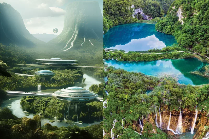
The Plitvice Lakes are located in the oldest and largest national park in the Republic of Croatia. This park is situated in the mountainous region of Croatia, nestled between the Mala Kapela mountain range in the west and northwest, and the Lika Plješivica mountain range in the southeast. With its unique natural beauty, this area has always attracted nature lovers and was introduced as Croatia’s first national park on April 8, 1949.
The process of Tufa formation (a type of limestone that forms when carbonate minerals precipitate from water in rivers or lakes) holds significant global value. This lake was internationally recognized on October 26, 1979, and listed on the UNESCO World Heritage Site list due to these limestone structures.
The National Park is covered with forest vegetation, with its smaller areas under grassland cover. The most attractive part of the park, the lakes, account for less than 1% of the total park area. There are sixteen lakes interconnected by a series of waterfalls that make this national park one wonders of the world.
Deep within the park’s forests, you can spot various species of deer, bear, wolf, wild boar, and rare bird species. The park covers an area of 300 square kilometers, with the lakes interconnecting within an 8-kilometer radius.
The national park is open to visitors and nature enthusiasts every day of the year. During summer, the park’s working hours are extended (usually from 7 a.m. to 8 p.m.), and the entrance fee, used for the maintenance and protection of the park, varies for adults between 10 and 40 euros depending on the month.
Viewing the Plitvice Lakes is not limited to summer. The park is a stunning place to visit at any time of the year. Throughout different seasons, the park landscape adopts various colors; green in spring and summer, rich and beautiful colors in autumn, and magical scenes of snow and ice in winter. Even when it rains, the park can offer an extraordinary environment for observation and exploration. The sight of water bubbles forming on the wooden paths beneath your steps adds a magical touch.
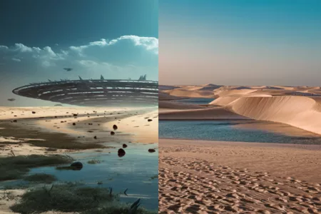
When you first gaze upon the shimmering heavenly pools that hallmark Lençóis Maranhenses National Park in Brazil, it feels like you are dreaming; thousands of dazzling blue lagoons have emerged from sandy dunes, creating a breathtaking panorama across an area equal to 598 square miles.
The Lençóis Maranhenses National Park in Brazil might appear unreal to those unfamiliar with nature’s wonders, but this extraordinary park is a genuine spectacle located 1662 miles north of Rio de Janeiro in the state of Maranhão, not a mirage nor a scene from a movie.
The Lençóis Maranhenses National Park is one of the world’s most striking sandy vistas and one of the world’s least frequented routes. This park is located in the northeastern part of Brazil, in a region of low, flat, and occasionally water-filled terrain, between massive sand dunes that, despite abundant rainfall, show virtually no vegetation coverage.
With its large, white, sprawling sand dunes, Lençóis Maranhenses National Park seems like a typical desert, but in fact, it’s not a desert. It is an area just outside the Amazon basin that has a regular rainy season during the first half of the year. When it rains, fresh water accumulates in the valleys between the sand dunes. Layers of rock beneath the sand prevent the water from sinking down, ultimately creating blue, green, and black lagoons that are surrounded by desert-like sands. The lagoons are in their best natural state for viewing between July and September.
When the lagoons fill with rainwater, they connect to river-like waterways such as the Rio Negro. These rivers are teeming with fish. However, one fish species in this region has a higher reputation, known as the “Wolf Fish” or “Tiger Fish” (Hoplias Malabaricus). This fish rests in the mud layers of moist areas after most of the lagoon water has evaporated, to re-emerge in the next rainy season.
Lençóis Maranhenses became a national park in 1981, and in 2014, the Chico Mendes Institute for Biodiversity Conservation in Brazil took responsibility for preserving this park’s biodiversity.
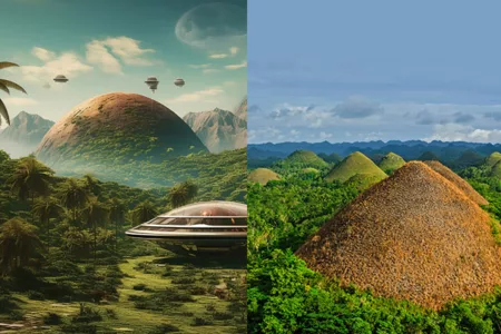
The Chocolate Hills of Bohol, Philippines are a bit of a mystery to locals and visitors alike. Sometimes called the “Eighth Wonder of the World”, these hills are the Philippines’ third national geologic monument, declared in 1988, and are depicted on the local flag of Bohol province.
The main attraction of this area is the round hills located in the center of a small island that turns brown during the dry season and eventually resembles giant chocolate truffles. Geologists classify these landforms as “conical karst topography”. These hills are remnants of limestone deposits from a time when rivers and streams were much higher than sea level. Rain and other natural water sources gradually created slopes and valleys that made Bohol Island famous.
There are a few perspectives on how these hills were formed; one local story says the hills resulted from a fight between two giants who spent many days throwing rocks at each other until they finally surrendered and retreated from the battle. Another view is that the hills are the tears of a giant mourning a woman he once loved.
The height of these hills is not very high and ranges from 100 feet to 165 feet, although one of them reaches 395 feet. The Chocolate Hills cover an area of up to 20 square miles and can be well seen from the towns of Batuan, Sagbayan, Bilar, and Carmen.
Access to the hills is possible by boat, with a 2-hour trip from Cebu to Tagbilaran, the capital of Bohol. You can also fly from Manila to Bohol-Panglao Airport, or take a boat from Manila, Siquijor, and various other ports to this island.
Aside from the 214 steps to the Chocolate Hills viewing deck at the Chocolate Hills Complex, there is a rest house atop the largest hill, located in Carmen Town. The complex also includes lodging, a restaurant, and a gift shop. Another excellent viewing deck is located near the town of Sagbayan, where the hills offer beautiful sea views between Bohol and Cebu.
This site was declared the country’s third national geologic monument on June 18, 1988. The Philippines Tourism Organization has included this area in the list of Philippine tourist destinations.
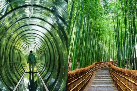
Forests are the very matter that supports nature. Without them, Earth would not be the planet we know. Scientists have shown great interest in the Sagano Bamboo Forest in recent years. Also known as the “Monkey Park,” this park is located in Kyoto, Japan, and is also known as the “Kyoto Forest” and “Japanese Bamboo Forest.” The Bamboo Forest covers an area of nearly 16 square kilometers, climate is unpredictable, relatively cool, sometimes sunny, and bright.
Summers are short, hot, and mostly cloudy, and the winters are very cold, windy, and semi-cloudy. Throughout the year, the temperature usually varies from 32 degrees Fahrenheit to 89 degrees Fahrenheit. The summer lasts for 2 to 3 months from June 23 to September 17, with an average daily temperature above 80 degrees Fahrenheit, and winters last for more than 3 months, from December 3 to March 18, with a maximum average temperature of 53 degrees Fahrenheit during the day.
The Sagano Bamboo Forest is world-renowned for its extensive wildlife and beautiful scenery. The unique bamboo gardens in this forest cannot be found anywhere else. This forest is famous for the natural sounds created in the early hours of the morning with the rustling and shaking of bamboo. These sounds have a special place in Japanese culture and are protected by the Japanese Ministry of the Environment.
The scenic Sagano Railway is a very attractive tourist attraction that passes through this forest. The Hozu River near the forest is also one of Japan’s most famous rivers.
This forest is a very diverse ecosystem. The animal species of the Sagano Bamboo Forest include giant pandas, mountain gorillas, and small bats. Common birds in this habitat include broadbill and dreamful.
Bamboo, the dominant plant in this forest, grows very quickly (36 inches in 24 hours). The pollination of bamboo is done by the birds and animals that live in this forest. In return, bamboo has also become a main diet for pandas and a home for bats and other small animals.
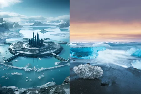
This icy lagoon, with its stunning beauty, is one of the most popular attractions in Iceland. Jökulsárlón means “glacial river lagoon” and is considered one of Iceland’s natural treasures and crown jewels. The nearby black beach is known as the Diamond Beach; as the icy pieces that cover its surface resemble diamonds shining under the sun.
Thousands of people are drawn to this area throughout the year to watch floating icebergs, explore the lagoons, and boats, and photograph seals. You can find accommodation in Höfn, a town near the glacial lagoon. If you’re traveling in winter, we recommend renting a suitable vehicle (like an off-road vehicle) for touring around Iceland. Also, you will have the opportunity to walk in the natural glaciers that lead water to the ice lagoon. You can join a tour to hike in the natural glaciers and explore more icy parts of Iceland.
With a maximum depth of 814 feet (248 meters), Jökulsárlón is Iceland’s deepest lake. It covers an area of 11.2 square miles (18 square kilometers) and takes approximately five hours to reach Iceland’s capital, Reykjavík. Icebergs in Jökulsárlón are made from ice more than 1000 years old. The formation of Jökulsárlón’s natural glaciers began for the first time in 1934, exactly when the famous natural glaciers known as Breidamerkurjokull began to retreat and left the lagoon in their path.
This glacial lagoon’s size has quadrupled since the early 1970s. The lagoon, formed from seawater and freshwater, connects to the ocean, giving the lake a unique color. Seals are seen in Jökulsárlón throughout the year, but in winter, they go to the lagoon mouth for fishing.
Icebergs that break off from the glacier and fall into the lagoon gradually melt and make their way to the sea; where the waves of the North Atlantic Ocean polish them before joining the Jet-black beach. On this beach, transparent icy sculptures on the surface of the black sand shine like diamonds under the sun’s light. That’s why this beach is sometimes also referred to as Diamond Beach.
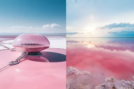
Chabahar Pink Lake, one of the sights of Chabahar in southeastern Iran, is a sight to behold. Traveling from Chabahar towards the Gulf of Gwadar, you will witness many beauties. Shortly, you will arrive in the village of Ramin, and after that, the pinkish and beautiful water will catch your attention.
This lagoon, created by the stagnation of water from the Gulf of Oman between two mountains, has created an interesting ecosystem. The lake is located on a rocky strait overlooking the mountain and offers a picturesque view. This lake is one of the saltiest waters in the world, with a beautiful and deceptive appearance that covers an area of about 10 hectares in winter.
There are not many facilities around the lake, and for this reason, the lake seems very calm. Occasionally, you will see native people selling seashells and sea salt or collecting salt from the lake. Despite all its simplicity, the lake is at the height of splendor and beauty. It is better to know that the Pink Lake of Chabahar is a rare natural phenomenon in the world. Similar to this lake in terms of rarity, one can mention Lake Hillier, the Blue Lagoon, Lake Spencer in Australia, Lake Retba in Senegal, and lakes located in South Africa, Vancouver, and Bolivia.
The pink water of Chabahar Lake reaches a yellowish coast and, combined with the greenery of plants and the blue of the sky presents a stunning picture to the viewer that cannot be found anywhere else.
The Pink Lake of Chabahar has good weather throughout the year; however, if you want to stay safe from the sun when visiting the Pink Lake, choose winter or spring for this trip.
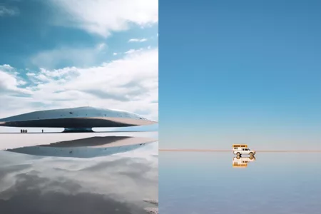
The Salar de Uyuni in Bolivia, located in the country’s northwest, is the world’s largest salt flat. Spanning an area of 4,050 square miles, this vast salt plain sits in Bolivia’s Daniel Campos Province. The flat, polygonal patterns of salt, creating a stunning landscape, are home to several lakes, dormant volcanoes, cacti, and birds like flamingos.
It is believed that around 42,000 years ago, these Bolivian salt flats were underwater, forming part of a prehistoric lake. As the lake evaporated and dried out over time, it left behind smaller bodies of water and salt pans, including the Salar de Uyuni.
Reportedly, the Salar de Uyuni holds approximately 12 billion tons of salt. Given that there was no outlet, salt accumulated, creating this natural wonder. The Bolivian salt region encompasses 30 islands and lakes. The lakes overflow during the rainy season, creating a beautiful mirror effect. These salt flats contain the world’s largest lithium reserves and are full of minerals like sodium, potassium, borax, and magnesium.
Salar de Uyuni is located at an altitude of 3,656 meters above sea level, and the winter temperature in the salt regions can drop to -20 degrees Celsius.
What you can experience in the Salar de Uyuni depends entirely on your preferences. There are other attractions around the salt flats, like the Incahuasi Island, with its towering cacti and rocky outcrops, where you can go for a hike. Additionally, many extended tours include visits to nearby villages, volcanoes, deserts, lakes, and hot springs that could make your experience memorable. Villages such as Jirira or Colchani and alpaca farms around the lake are also ideal choices for visits. One can observe flamingos in the red lagoons. The Bolivian salt flats have very hot days and very cold nights.
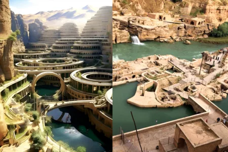
The ancient hydraulic structures of Shushtar were constructed by the Sassanid dynasty to direct the water of the Karun River for irrigation and agriculture. The most striking of these structures is the Caesar Dam; a bridge-like structure that is over 500 meters long and comprises a set of canals, gates, dams, and tunnels that control the flow of water. This system also includes a large reservoir known as the Shushtar Historical Hydraulic System and several Qantas (underground channels) that bring water from the nearby mountains to the city.
The ancient water structures of Shushtar are located in the city of Shushtar, Iran. The most famous of these structures is the Shushtar Historical Hydraulic System, which consists of a complex of channels, dams, and bridges dating back to the fifth century BC.
Access to the water structures of Shushtar is via road. The city is located near the Karun River, and visitors can use local buses or taxis to get from the city center to the water structures. These structures are also accessible by boat, and for this purpose, some local tours are offered to tourists in this area.
The people of ancient Iran used the structures to direct water from the Karun River to a set of canals to provide the necessary water for agriculture and the energy of several large mills for grinding grains. Also, these structures served a defensive role, with gate-like valves that could open or close to control the flow of water.
Today, this engineering masterpiece of ancient Iran continues to be used by local inhabitants and provides irrigation for local farmers. The various parts of the Shushtar water structures include the hydraulic system, the Caesar Dam, the Gargar Canal, the Shushtar waterfalls, and the Qanat system.
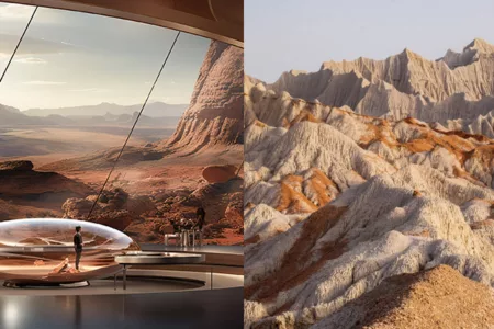
Most tourists who step onto the path from Chabahar to the Miniature Mountains for the first time say, “I’ve seen these landscapes in movies.” The truth is that the Martian (or miniature) mountains of Chabahar are part of lesser-known attractions in the real world, not the fictional world of films.
On the road, there are many ups and downs. Sometimes, you face the dark blue water of the Gulf of Oman and its golden beach on one side, and multidimensional white-gray mountains on the other. Indeed, it might be hard for you to choose which side to go to.
You cross a bend and the Miniature Mountains get very close. When you reach the bottom of the hill, they distance themselves, and you walk on a stretch of cracked soil like a mirage. Then you are in a cracked desert, under a blue sky, with crumpled short and tall mountains in the distance. Due to erosion caused by exposure to wind and rain, the mountains have many sharp-edged cracks. Many local people still call these mountains “Kolani” or “Aryan Mountains”. But because of their special shape, ups and downs, and beauty, they are also called miniature or Martian mountains.
The height of these mountains ranges from 5 to 100 meters. Their texture is very resistant, and the surface is as hard as a rock. With these features, only a few people climb these mountains, as the pleasure of watching Miniature Mountains is more than climbing. The furrows on the mountains have no vegetation.
Geologists have different narratives for the formation of Martian mountains; some say these mountains are a continuation of the Zagros mountain range and eventually end in Pakistan, while others believe that these mountains were buried under tons of soil in the past and over time they have appeared and exhibited their true face as climatic changes. Seasonal rains wash the soil. People believe that the wide horizon of the region can be used to observe and admire the infinitely beautiful space of the stars.
Similar to Martian mountains, they also exist in South Khorasan, Bandar Abbas, Khuzestan, and Qeshm. The mountains are a source of income for local people; they bring their decorated camels to the mountain and ride tourists for money. A few minutes further from the Martian mountains is Ramin village with an eco-lodge. On the coast of this village, there is a surfing club where tourists can enjoy surfing. Near the Martian mountains, a cabin has been set up for tourists to rest. Inside, the cabin is cool and the scent of reeds helps you to better adapt to the environment. If you plan to stay overnight, you can spend the night in the guesthouses of Ramin village.
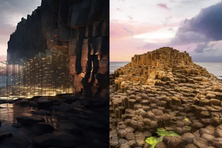
The Giant’s Causeway is renowned for its remarkable geological features, captivating visitors with its awe-inspiring phenomena. Not only does it offer a breathtaking rocky coastal causeway, but it also showcases extraordinary sights such as the Giant’s Boot, the Wishing Chair, and the Organ of Giants, which are truly enchanting to behold.
Situated beneath the basalt cliffs along the Northern Ireland coast, in alignment with the Antrim Plateau, the Giant’s Causeway boasts approximately 40,000 massive black columns rising from the sea. This mesmerizing landscape has given rise to legends of giants who once roamed from the sea to Scotland. Over the past 300 years, geological studies have significantly contributed to our understanding of the Earth’s processes, revealing that this magnificent sight formed through volcanic activity during the third geological era, around 50 to 60 million years ago.
For centuries, countless visitors have explored and ventured along the pathways of the Giant’s Causeway, marveling at its unique rock formations. These unparalleled rocks grace one of the most picturesque shores in the world, enduring the relentless onslaught of North Atlantic storms for nearly sixty million years. The asymmetrical arrangement of the columns has never diminished their allure and captivating charm for visitors, as it allows them to step into the past and traverse through time.
In recognition of its exceptional value, the Giant’s Causeway was inscribed on the UNESCO World Heritage List in 1986. This site has become a habitat for approximately 50 bird species and over 200 plant species, owing not only to its scenic beauty but also its rocks, coastal cliffs, marshes, and grasslands. Although humans settled around the Giant’s Causeway in the 19th century, it is currently uninhabited. Nevertheless, it continues to attract approximately 300,000 tourists annually, who are drawn to its undeniable allure.
Asking AI to write about a touristic sight in Iran is one of the most challenging tasks, and the reason for that is the lack of reliable information about Iran’s travel destinations. In fact, before working with artificial intelligence, you should provide it with data about that location, write clear instructions for it, and determine the tone of the content. This interesting experience of co-writing with artificial intelligence is presented to you, the regular fans of the Sepehran blog.